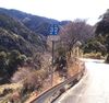
A paved mountain road with a signpost indicating it is (in English translation) “Shizuoka Prefectural Route 32” and below that “Fujieda Kuromata Right of Way / Fujieda City, Ichi-no-Se District”
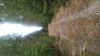
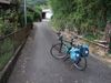
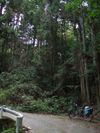
The handlebar of bike is at the bottom of the photograph, standing above a small narrow forested gorge cut by a small stream extending below on the right, with a roadway suspended along the mountainside to the left.